


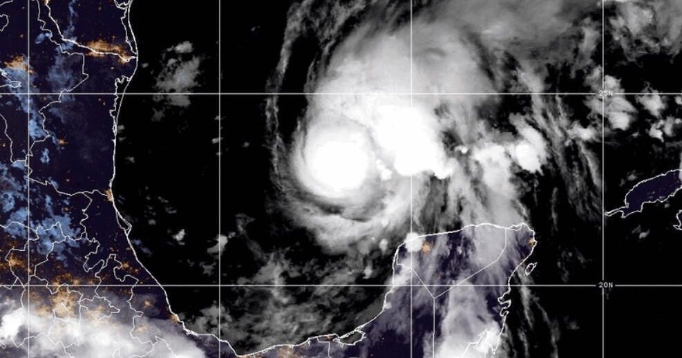
Hurricane Isaias has intensified from a tropical storm into a hurricane as of late Wednesday night, making it the first hurricane of the 2026 Atlantic hurricane season. As it approaches the U.S. Gulf Coast this weekend, it poses a significant threat to regions including Mississippi, Alabama, and the western part of the Florida Panhandle.
A hurricane warning has been issued for the northern Gulf Coast, covering the area from Ocean Springs, Mississippi, to the Bay/Gulf County line in Florida, including Alabama.
Florida Governor Ron DeSantis has declared a state of emergency for over 25 counties within the state, while Alabama Governor Kay Ivey has expanded a state of emergency to cover approximately 40 counties.
Forecasted Path and Impact
Currently, Hurricane Isaias boasts maximum sustained winds of 75 mph and is situated around 460 miles southwest of the mouth of the Mississippi River, according to the National Hurricane Center. Experts anticipate that Isaias will land late Friday or early Saturday.
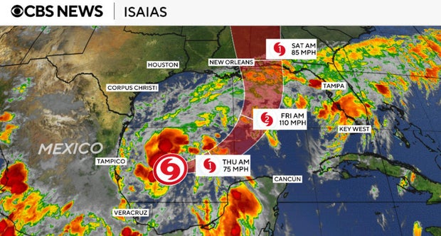
The National Hurricane Center warns that as Isaias approaches the Gulf Coast, it is expected to become a stronger hurricane, generating potentially life-threatening storm surges.
In addition to the hurricane warning, there is a tropical storm warning from Louisiana’s Jefferson/Plaquemines Parish line to west of Ocean Springs, Mississippi, as well as from east of the Bay/Gulf County line to Florida’s Aucilla River. A storm surge warning is also in effect from the mouth of the Mississippi River to the Steinhatchee River in Florida.
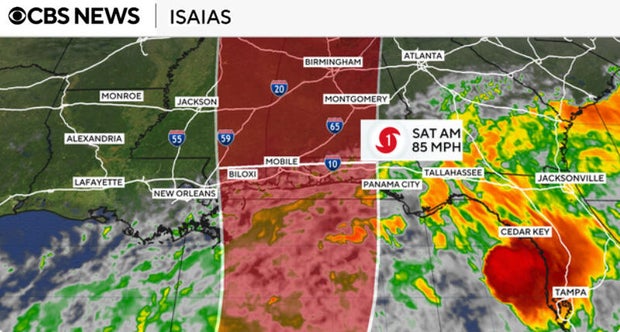
Forecasters project that areas from southeastern Louisiana to the Florida Panhandle could receive between 3 to 7 inches of rain, with localized areas possibly accumulating up to 10 inches. Additional rainfall could also affect regions much further north, extending into the Tennessee Valley and the Carolinas.
Historic Timing of the First Hurricane
The development of Isaias marked the latest date for the formation of the Atlantic season’s first hurricane in 121 years, narrowly missing a record set on October 8, 1905, as reported by the National Oceanic and Atmospheric Administration (NOAA).
This Atlantic hurricane season spans from June 1 to November 30. Typically, an average season sees about 14 named storms, 7 hurricanes, and 3 major hurricanes. The first named storm usually forms in mid- to late-June; the first hurricane generally appears in early to mid-August, while the first major hurricane is expected by late August or early September.
Forecasters initially indicated a below-average level of storm activity for this hurricane season; however, conditions have proven quieter than expected. Meteorologists attribute this calm to the influence of a strong El Niño phenomenon over the summer, which is known to correlate with cooler water temperatures and varying wind patterns that suppress the development of tropical systems. Conversely, the Pacific Ocean has experienced an unusually active hurricane season.
