


Unprecedented Storm Activity in Southern California Driven by Record Cyclone Energy
Southern California is experiencing a historic season of tropical storms and hurricanes, marked by record-breaking energy in the Pacific Ocean.
Record-Breaking Cyclone Energy
Colorado State University researchers announced that the accumulated cyclone energy (ACE) for this summer has reached an unprecedented level, surpassing the previous seasonal record set in 2018. ACE quantifies the total wind energy generated by tropical storms and hurricanes over time.
Coastal Impact and Damage Reports
Daniel Cayan, a climate researcher at the Scripps Institution of Oceanography, described the season as “wild,” noting significant coastal damage in Southern California even before the onset of winter storms associated with a remarkably strong El Niño.
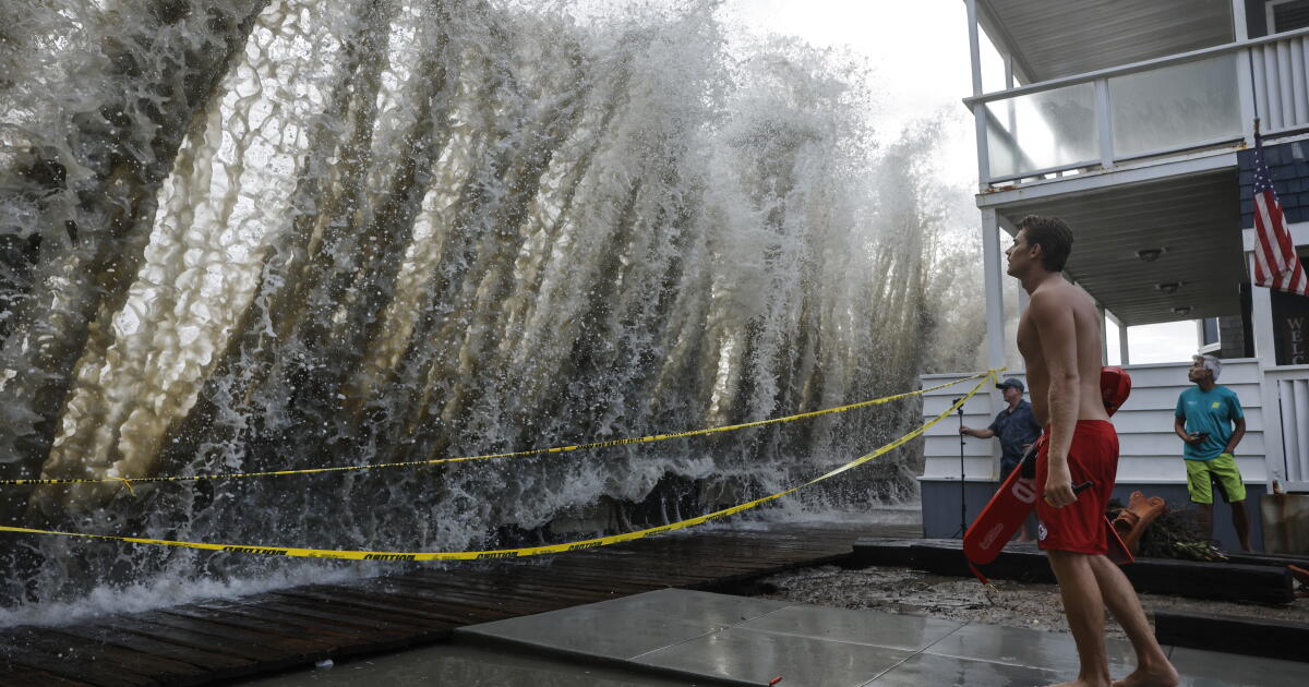
For instance, the Long Beach boardwalk suffered severe structural issues due to relentless storms over the last month. As Tropical Storm Rachel approached, crashing waves threatened oceanfront properties, with some homes reportedly on the verge of collapse.
In Newport Beach, unexpected swells—twice as high as forecasted—breached protective berms, resulting in road flooding from approximately one foot of seawater.
The relentless coastal assaults have dramatically reshaped local beaches and eroded sand at locations including the Wedge in Newport Beach, San Onofre, Laguna Beach, and San Clemente. The situation has prompted Orange County officials to declare a local emergency.
Factors Contributing to the Active Hurricane Season
The current hurricane activity in the Pacific is influenced by various elements, such as global warming-induced ocean heating trends, elevated nearshore ocean temperatures, and reduced wind shear due to El Niño conditions, which typically impede hurricane formation.
“El Niño in the Pacific Basin decreases wind shear, so it removes the inhibitive storm-decapitating effect of wind shear at the same time that it amplifies water temperature,” said Daniel Swain, a climate scientist with UC Agriculture and Natural Resources. This combination enhances the potential for hurricanes to form and approach the coast.
Future Projections and Risks
Experts predict that the storm season is far from over. Hurricane Simon is currently near Mexico’s west coast, and forecasters have indicated a 90% chance for new cyclone formations within the next week.
Additionally, Southern California is preparing for the winter impacts of El Niño. The National Oceanic and Atmospheric Administration’s Climate Prediction Center recently updated their forecasts, now estimating a nearly 100% chance that the current El Niño will be classified as “very strong,” with an 83% likelihood of it being the strongest on record since 1950.
Potential Winter Implications
While El Niño can lead to increased rainfall, its effects often extend to coastal erosion and flooding. Typically, winter storms erode beaches more severely, and the conditions this season could exacerbate sand loss significantly.
As Cayan mentioned, “There’s likely to be pretty profound influences along the coast.” Historical data indicates that potent El Niño events, like those in 1982-83 and 1997-98, caused extensive damage to Southern California’s coastal infrastructure.
Moreover, previous El Niño conditions have resulted in extreme wave activity, which, during the 2015-16 season, led to record beach erosion. This year, if El Niño-enhanced storms coincide with king tides—predicted during holidays like Thanksgiving and Christmas—devastating coastal impacts could ensue.
