Cold Front Brings Severe Weather to the DC Region
A powerful cold front is set to disrupt the summery weather this Friday, ushering in a series of gusty showers and thunderstorms that could become intense. Following the passage of this front, residents can anticipate a marked temperature drop and strong winds, leading into a blustery Saturday and a potential frost on Sunday morning.
Timing and Intensity of Showers and Storms
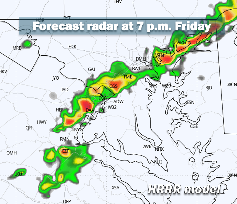
Forecasts indicate that the line of showers and thunderstorms will likely make its way to the DC area between 5 and 9 p.m. on Friday. The initial impact will be felt in the western suburbs, moving towards the Beltway around 6 to 8 p.m. Although the storms will pass swiftly—often within 30 minutes—they may be accompanied by severe conditions.
The National Weather Service has issued a severe thunderstorm watch for the entire DC region until 8 p.m., with increasing intensity expected particularly in northern areas.
Main Hazards of the Storm
The primary risk associated with this front includes damaging wind gusts, which may occur suddenly. Peak gusts are forecasted to reach between 50 and 65 mph, with potential for downed trees and isolated power outages.
Temperature Drop and Wind Forecast
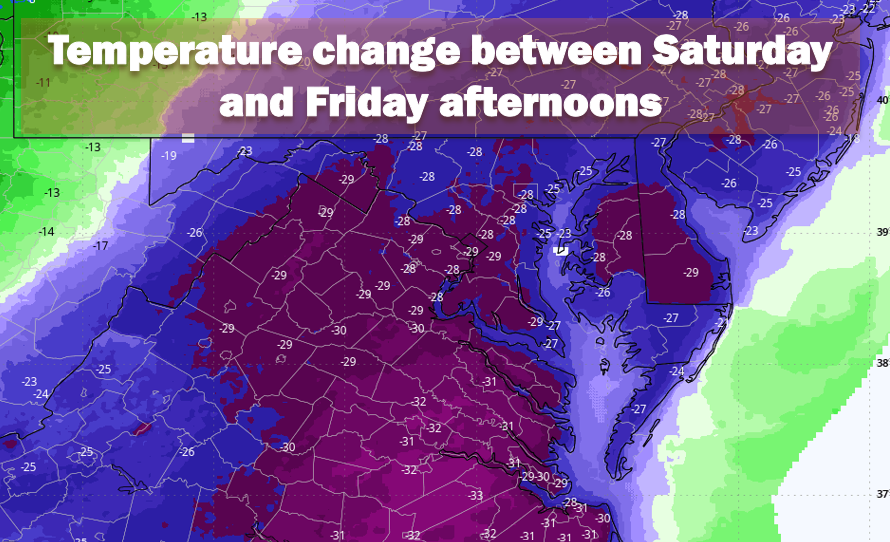
After the squall line moves through, a few residual showers may linger overnight, particularly east of Interstate 95. However, the more significant change will be the temperature decline. Following highs near 80 degrees Fahrenheit on Friday, temperatures are expected to plummet, with lows dipping to around 50 degrees by Saturday morning—almost a 30-degree drop within 12 hours.
Winds will strengthen, with gusts of 20 to 30 mph beginning late Friday night and persisting throughout Saturday. Daytime highs will struggle to reach the mid-50s, marking a stark contrast to Friday’s warmth.
Potential for Frost on Sunday Morning
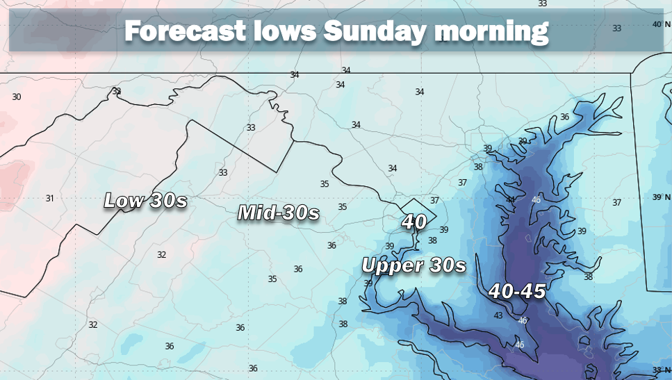
As conditions settle under clear skies Saturday night, temperatures are expected to reach their lowest this season, posing a risk of frost in cooler areas. Overnight lows are anticipated to drop into the mid- to upper 30s, with higher urban areas, like downtown Washington, remaining in the low 40s.
This frost threat is particularly relevant for areas west of Interstate 95, where valleys and low-lying regions may see patchy frost develop.