


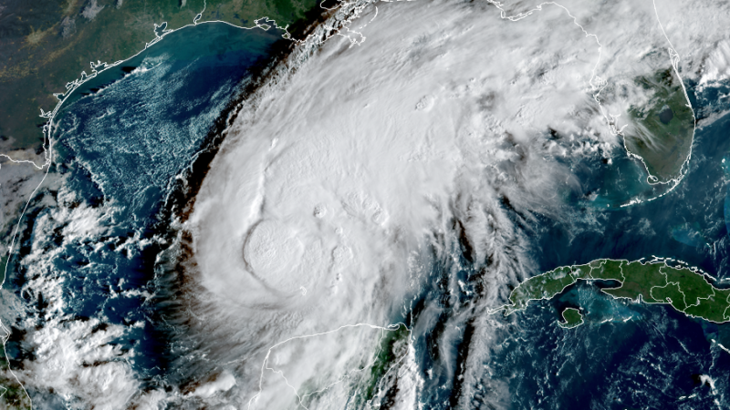
Impact of Tropical Storm Isaias
Tropical Storm Isaias is poised to strike the Southeastern United States, with a focus on southern Alabama and the Florida Panhandle. The storm is expected to bring significant rain, potentially leading to flash flooding in certain areas.
Forecasted Rainfall and Flood Risks
- Southern Alabama and the Florida Panhandle may accumulate between 4 to 8 inches of rain, with localized areas possibly receiving up to 15 inches.
- While the storm’s swift movement and dry land conditions will limit widespread flash flooding across most of the Southeast, regions could still see significant rain totals ranging from 1 to 3 inches, with isolated instances of up to 5 inches.
- Periods of heavy rain are expected to intensify along coastal areas on Friday, spreading further inland throughout the weekend.
Wind Impacts
Tropical storm-force winds, classified as winds of 39 mph or higher, are forecasted to reach southeastern Louisiana by Friday morning. As the day progresses, these winds could also impact parts of Mississippi, Alabama, and the Florida Panhandle by Friday afternoon.
By Friday night into early Saturday, areas directly impacted by Isaias’s landfall could experience hurricane-force winds of 74 mph or more.
Potential for Power Outages
The anticipated wind gusts pose a significant risk for power outages and downed trees, particularly from southeast Mississippi through southern Alabama and into the western Panhandle. Wind gusts between 30 to 50 mph may extend throughout parts of central and northern Alabama as well as northeast Mississippi on Saturday.
Storm Surge Concerns
A dangerous storm surge is likely, especially near and to the east of where Isaias makes landfall on Friday night. Coastal regions in Alabama and the western Florida Panhandle could witness inundation levels reaching between 5 to 7 feet, particularly if peak surge coincides with high tide. Such conditions threaten to flood roads and severely damage coastal structures.
Tornado Threat
In addition to heavy rainfall and high winds, Isaias may spawn a few tornadoes, particularly within its rainbands from Friday night into Saturday. The areas east of the storm center are expected to face the most significant risk. It is important to remain vigilant, as tornadoes associated with tropical systems often form with little warning.
Summary of Expected Conditions
In summary, Tropical Storm Isaias is projected to bring:
- Heavy rainfall with localized flooding potential in southern Alabama and Florida.
- Tropical storm and hurricane-force winds across affected regions.
- Storm surge inundation risks along the coast.
- The chance of tornadoes, particularly east of the storm’s center.
Residents in the affected areas are advised to prepare for the incoming weather and stay tuned for updates from local authorities.
