


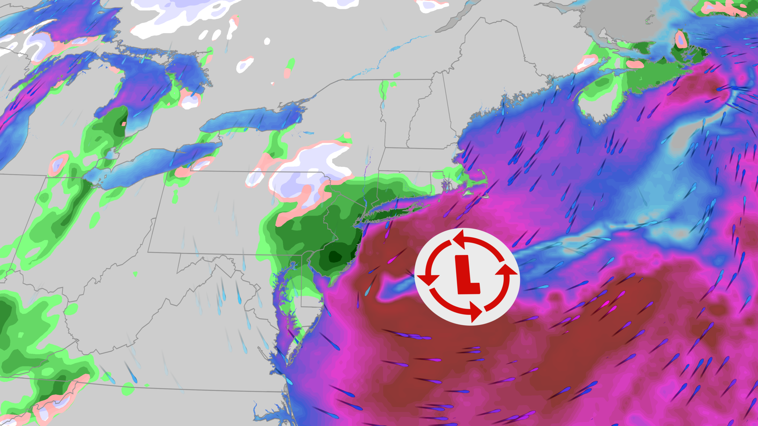
Nor’easter Set to Bring Snow and Frosts to the Northeast and Southeast
What to Expect from the Coming Storm
A developing nor’easter is predicted to bring the first significant snow accumulation of the season to various regions in the interior Northeast and the Great Lakes snowbelt. In addition to snowfall, this system is expected to introduce the initial frosts and freezes across parts of the Eastern and Southeastern United States.
Timeline of the Storm
Thursday
The storm will commence with widespread rainfall across much of the Northeast, accompanied by increasing winds. Areas in the hilly regions may experience a transition from rain to wet snow by late Thursday. Meanwhile, lake-effect precipitation is anticipated in the western Great Lakes.
Friday
As the system progresses, rain will continue in southern New England, including the New York City metro area and New Jersey. The precipitation is likely to turn to wet snow in the interior Northeast, particularly over elevated terrains. Lake-effect rain and snow will persist in the western Great Lakes, with sporadic rain or wet snow possible in the Ohio Valley.
Saturday
On Saturday, lingering lake-effect rain and snow showers will be observed across parts of northern New England and the Appalachians, along with continuing brisk north to northwest winds throughout the Northeast.
Areas Expected to See Snow Accumulation
The most favorable locations for accumulating wet snow include:
- The Green and White Mountains in Vermont and New Hampshire
- The Berkshires in western Massachusetts
- The Adirondacks and Catskills in New York
- The Appalachian Mountains from West Virginia to western North Carolina
- Portions of western upper Michigan, especially away from the lakeshores
Additionally, brief snow showers may occur as far south as northern Indiana, northeast Ohio, southwest New York, and parts of the Ohio Valley.
First Frosts and Freezes
The advancing chill from the storm will extend into the Midwest and deeply into the Southeast, leading to potential freezing temperatures this weekend. Areas at risk for their first freeze include:
- Much of the Carolinas
- Northern and central Georgia
- Northern and central Alabama
Residents in these regions are advised to take precautions with sensitive plants, possibly bringing them indoors to avoid cold damage.
Daytime temperatures are forecasted to remain in the 40s in many parts of the Midwest and Northeast, while areas in the Carolinas and Tennessee Valley may struggle to reach the 50s.
Understanding the Nor’easter
A nor’easter is defined by a low-pressure system off the East Coast that generates northeasterly winds. These storms can occur year-round, though they are more common in winter months when colder air is prevalent, facilitating snow accumulation.
For this instance, the nor’easter is not anticipated to be particularly severe. The low-pressure system is expected to be relatively weak with only a small pressure gradient compared to high pressure over Canada. Consequently, the rainfall along the northeastern coast is unlikely to cause widespread flooding, and any coastal flooding due to onshore winds is expected to remain at minor levels during high tide.
