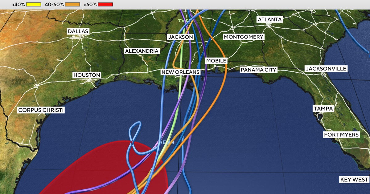
As the 2026 hurricane season approaches its concluding weeks, meteorologists are monitoring the development of what may become the ninth named tropical storm in the Atlantic. This potential storm is currently forming over warmer waters in the southern Gulf of Mexico.
This season, which commenced on June 1, has recorded only eight named storms so far. The ongoing influence of El Niño appears to be contributing to a more dynamic storm activity in the Pacific region, while the Atlantic basin remains relatively calm. The hurricane season officially wraps up on November 30.
Forecasting the Path of Tropical Depression Nine
Tropical Depression Nine emerged in the Gulf on Tuesday and is anticipated to transform into a tropical storm by early Wednesday, with expectations of reaching hurricane status by Thursday, per the updates from the National Hurricane Center.
Should it strengthen into a tropical storm, it will take on the name Isaias, pronounced as “ees-ah-EE-ahs.”
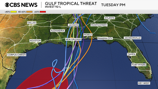
Early forecast models are aligning, suggesting that the system will move northward toward the Gulf Coast by this weekend.
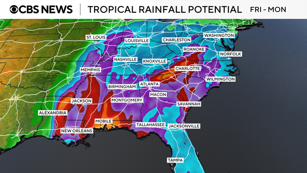
No matter its classification, this system is expected to generate significant rainfall across the Gulf Coast and into surrounding southeastern states from this weekend into the early part of next week.
Long-range models also indicate the possibility of this moisture spreading to the Ohio Valley and Northeast regions by the middle of the next week.
Uncertainties Surrounding the System
Key details such as the timing and intensity of the storm, as well as the potential impact on land, remain uncertain. Some prediction models suggest the storm could start affecting regions on Friday evening, while others indicate later impacts over the weekend.
In preparation for the storm, Florida Governor Ron DeSantis issued an executive order declaring a state of emergency for 25 counties. This order is designed to equip communities with the necessary resources for potential severe weather challenges that may arise particularly in the Panhandle and Big Bend regions of Florida.
The Significance of “I”-Named Storms
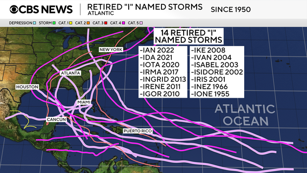
Historically, storms designated with names starting with the letter ‘I’ have frequently been retired from use due to their severe impacts. Notable examples include Ian (2022), Ida (2021), Irma (2017), and Irene (2011).
When Ike was retired in 2008, the name Isaias was introduced as part of the rotational naming system in the Atlantic, which cycles every six years.