


Hurricane Isaias Intensifies Near Gulf Coast
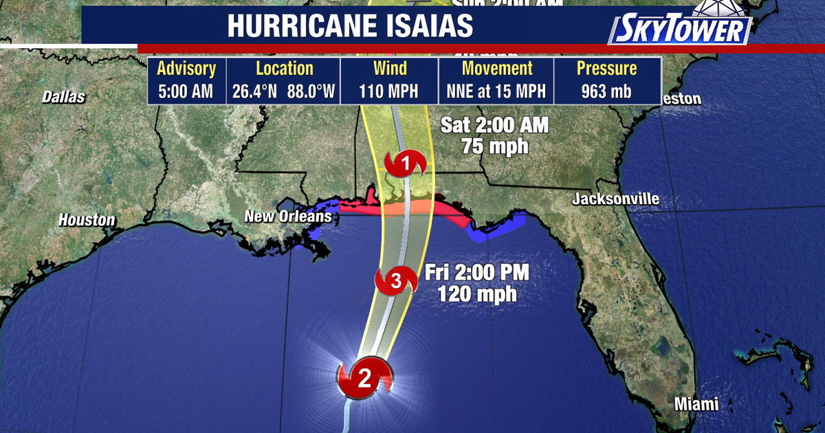
TAMPA, Fla. – As of Friday morning, Hurricane Isaias has strengthened significantly, reaching maximum sustained winds of 110 mph. Forecasters indicate the storm is on the brink of achieving Category 3 hurricane status while making its way towards the northern Gulf coastline.
Current Status of Hurricane Isaias
As it approaches the Gulf Coast, Hurricane Isaias is garnering attention due to its rapid intensification. Meteorologists emphasize the potential for further strengthening, with winds currently reported at 110 mph.
Warnings and Expected Impacts
Hurricane warnings remain active for regions stretching from Ocean Springs, Mississippi, to the Bay/Gulf County line in Florida. Key concerns include:
- Storm surge projections indicate levels reaching between 5 and 7 feet near the center and east of the predicted landfall.
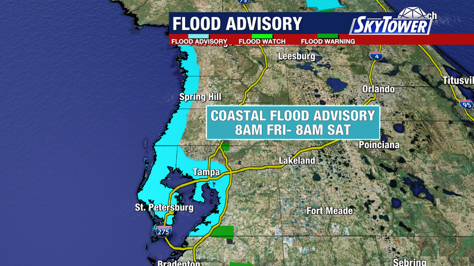
- An additional 1 to 3 feet of surge is anticipated from Citrus to Pinellas counties as the storm impacts the area through the weekend.
Future Forecast and Coastal Flooding
While the immediate weekend forecast includes potential tropical downpours, forecasters predict the arrival of drier conditions. Key points include:
- Rain is likely to continue contributing to minor coastal flooding.
- By Monday, conditions are expected to clear with a drop in humidity, leading to sunnier weather.
Uncertainties of the Storm’s Path
As the situation develops, specific details regarding the storm’s timing and exact landfall site remain undetermined. Additionally, the extent of potential localized flooding in coastal regions under advisory remains uncertain.
