


Possible Late-Week Nor’easter May Bring Snow and Freezing Temperatures
This week, the Northeast and Great Lakes may face significant weather changes due to a developing nor’easter, expected late Friday through the weekend. The system is forecasted to bring cold temperatures, snowfall, and heavy rain, impacting millions across the region.
Current Forecast Overview
As weather models continue to evolve, uncertainty regarding the formation and trajectory of this nor’easter persists. However, some details have become clearer:
- Temperature Drop: A significant drop in temperatures is anticipated, with highs expected to decrease by 20 degrees from Wednesday to Friday across cities such as Chicago and Atlanta. By the weekend, lows are predicted to plummet to the 30s, even reaching the Florida Panhandle.
- Low Pressure System: Meteorological models suggest a low pressure system will form and move through the Midwest by Wednesday, intensifying as it reaches the Ohio Valley. This will bring rainfall from Georgia to Michigan.
Developments on Thursday Evening
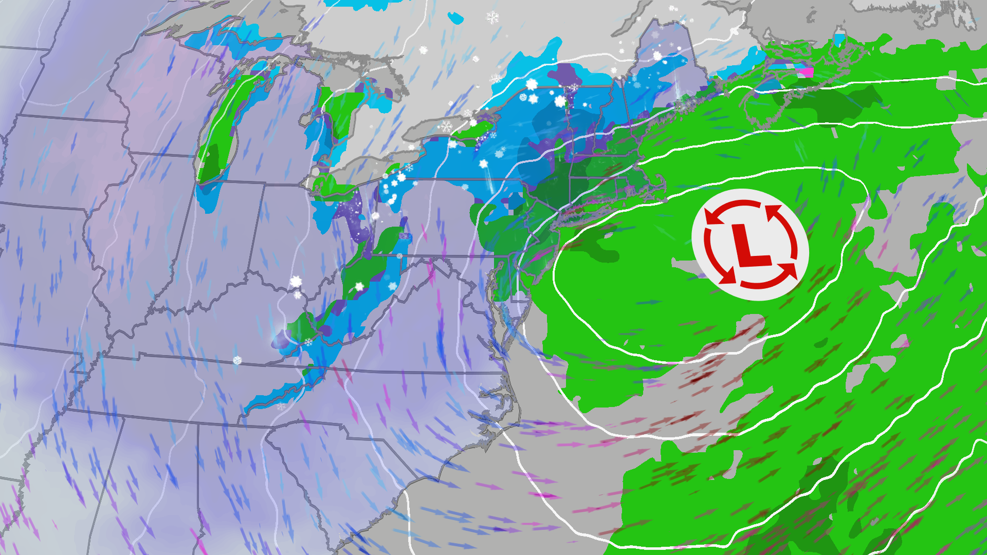
By Thursday night, another low-pressure area is expected to materialize offshore the Eastern Seaboard. At this juncture, rain may transition to wet snow, particularly in parts of the interior Northeast.
Looking Ahead: Friday and the Weekend
The forecast for Friday into the weekend becomes more complicated. Variations in model predictions indicate differing impacts:
- Some models suggest the low will remain close to the coast, potentially leading to strong winds and coastal flooding, mainly affecting regions from the northern Outer Banks of North Carolina to New England. This scenario may result in heavier rain and snow upstate.
- Alternatively, other models indicate a position further out to sea, predicting lighter rainfall and less wind but still maintaining a threat of coastal flooding during high tides.
The greatest probability of snow accumulation appears to be centered in the mountains of northern New England, upstate New York, and the Appalachian region. Metropolitan areas along the I-95 corridor are likely to avoid significant snowfall due to higher expected temperatures. However, some light snowfall may occur in lake-effect bands as cold air interacts with the warm waters of the Great Lakes, marking the ‘first wintry weather’ for numerous locations.

Understanding Nor’easters
A nor’easter is defined as a low-pressure system off the East Coast that generates winds from the northeast. While they can occur year-round, these storms are most frequent in winter months and typically produce snow when cold air is present.
For more detailed weather updates throughout the week, please visit reputable weather sources.
