


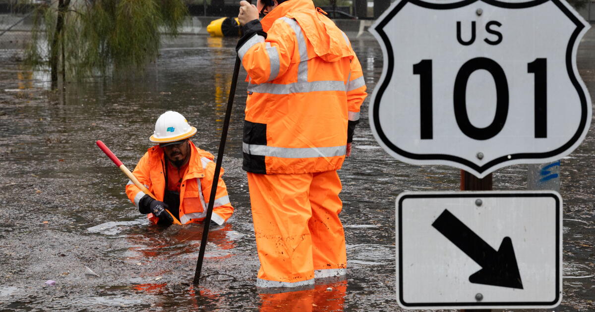
Southern California Prepares for Major Storm Impact
Southern California is gearing up for its first significant atmospheric river event of the season, predicted to bring a mixture of rain, strong winds, large ocean swells, and mountain snow from late Wednesday night into Thursday. The National Weather Service has alerted residents to potential hazards associated with the storm.
Forecast and Warnings
Forecasters anticipate that the storm system will deliver widespread rainfall, particularly affecting the city of Santa Barbara and western Ventura County during the early hours of Thursday, between 2 a.m. and 5 a.m. The rain is expected to reach Los Angeles County by mid-morning.
This storm occurs amid a notably strong El Niño, which has been associated with warmer ocean temperatures and rising sea levels, contributing to expectations of a wetter-than-usual winter across Southern California.
Expected Conditions
- Rainfall Rates: Potential rates of half an inch per hour, with localized areas possibly receiving up to an inch per hour.
- Flood Watch: Issued for Santa Barbara, San Luis Obispo, Ventura, and Los Angeles counties, excluding the Antelope Valley.
- Thunderstorm Probability: A 20% chance exists for thunderstorms that could result in heavy downpours and strong winds.
- Wind Advisory: In effect for San Luis Obispo and much of Santa Barbara County through early Thursday morning.
Evacuation Alerts and Safety Measures
Residents living near recent fire burn scars in Los Angeles County have been issued evacuation warnings due to the increased risk of flooding and debris flows. Areas affected include locations near the Eaton, Palisades, Sunset, Kenneth, Hurst, and Canyon fires. The evacuation warning is in effect from 6 p.m. Wednesday until 8 a.m. Friday.
Authorities are advising all residents to stay away from flood-prone areas, such as flood control channels and natural waterways.
Rainfall Projections
Total expected rainfall ranges from 1 to 3 inches in most areas, while coastal slopes and foothill regions could see 3 to 5 inches. Interior parts of the region may receive less than an inch.
State Preparedness Initiatives
In response to the anticipated storm, California’s State Operations Center has been activated for coordinated action, focusing on resource allocation to at-risk communities. Local fire department personnel are being pre-positioned, alongside the necessary rescue teams and equipment.
Inclement Weather Across the State
Northern California has already experienced the storm’s impact, with heavy rains causing flooding and significant travel disruptions in areas like San Francisco. Affected services included delayed flights and interruptions at major events due to water damage.
Winter Snow Accumulation
In the mountainous regions, forecasts indicate snowfall between 4 to 8 inches at elevations above 7,000 feet and 1 to 3 inches above 5,500 feet as part of the storm system. Early snow measurements have shown promising numbers, indicating a strong start to the winter season.
Future Weather Outlook
Looking ahead, another storm could arrive early next week, with the potential for additional rainfall, particularly along the Central Coast, where light precipitation is possible. The National Weather Service continues to monitor conditions, as high surf and strong winds are expected to contribute to hazardous ocean conditions through the week.
Community Safety Advisories
As the storm develops, officials urge all residents to remain vigilant and prepared for changing conditions, including the possibility of road closures and power outages due to severe weather. The situation will be closely monitored, and timely updates will be provided to ensure public safety.
For the latest storm updates, residents are encouraged to stay informed through local weather services and emergency management offices.
