


Subtropical Storm Josephine: Impacts and Updates
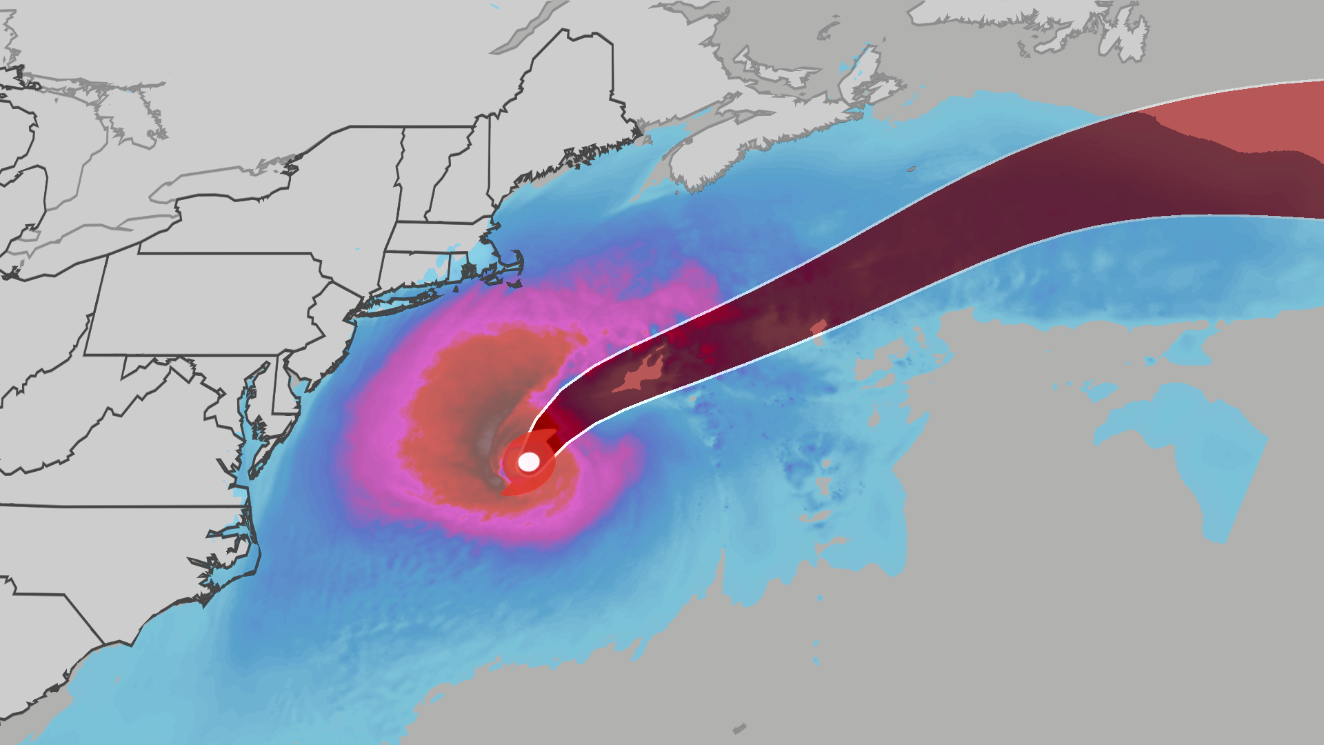
As an October nor’easter continues to travel along the Atlantic coast, the National Hurricane Center has officially designated the system as Subtropical Storm Josephine.
Current Status and Forecast
Subtropical Storm Josephine is expected to remain primarily offshore, making a northeastward progression. Forecasts indicate a potential increase in intensity, with the storm possibly reaching sustained wind speeds of up to 80 mph by Friday. While the most severe winds and rains will stay offshore, heightened rip current risks pose a danger along the coast for the remainder of the week.
Potential Impacts Along the East Coast
Although Josephine is not predicted to cause as much disruption as the late September nor’easter, it may still have several significant effects on the East Coast:
- Coastal Flooding: Areas particularly vulnerable to flooding extend from the Delmarva Peninsula down to eastern North Carolina. Coastal flood alerts are in effect for the Outer Banks of North Carolina, where inundation could range from 1 to 4 feet. High surf advisories are also active, with wave heights potentially reaching 14 feet along the coastline.
- Winds and Rain: As the storm shifts north, the strongest gusts have transitioned from the Carolinas toward New England, with enduring winds capable of downing power lines in coastal regions. While significant rainfall is unlikely, intermittent showers may affect coastal areas sporadically throughout the week.
Flood Watches and Weather Alerts
As Josephine approaches, the risk of moderate floods along river gauges from North Carolina to Maryland may increase during high tide conditions. High surf and coastal flooding hazards will extend as far south as Florida and as far north as New England, leading to considerable beach erosion across the East Coast.
Key Areas of Concern
Special attention should be given to the following regions:
- North Carolina’s Outer Banks: Anticipated inundation of 1 to 4 feet and potential for life-threatening rip currents.
- Virginia, Maryland, Delaware, and New Jersey Coasts: Projections indicate possible flooding of up to 2 feet and wave heights reaching up to 10 feet.
Safety Recommendations
Residents and visitors along affected coastlines should take necessary precautions, including:
- Monitoring local weather updates closely for the latest alerts and advisories.
- Avoiding beach activities that could be hazardous due to high surf and rip currents.
- Being prepared for potential power outages and flooding.
For more comprehensive weather updates and live tracking of Subtropical Storm Josephine, consult your local weather service.
Jonathan Erdman, a senior meteorologist at weather.com, has extensive experience in both national and international weather reporting. Learn more and stay informed by following updates on his social media platforms.
